The Forestry Commission
...
in Scotland allow geocaches to be placed anywhere on their land (subject to conditions as outlined in the Landowner Database).
You can download maps of each forest district that will open in Google Earth which is a free download for a PC and also as apps for Apple and Android. All maps are provided for information only and may not necessarily be up to date or accurate. It is the responsibility of the cache owner to check a location. Forestry Commission maps are provided under the terms of the Open Government Licence. There is also an interactive map that lets you enter coordinates and search.
...
Forest District Maps
Inverness and Moray
Galloway Forest
Dumfries and Borders
Cowal and Trossachs
West Argyll
Tay
North Highlands
Moray and Aberdeenshire
Lowlands
Lochaber
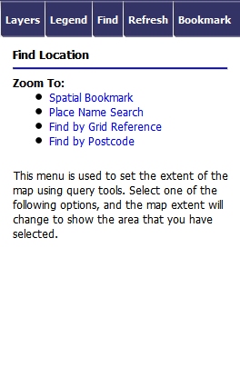
Interactive Map
This interactive map allows you to find and view Forestry Commission owned land within Scotland. There are many agreements with the FC for Scotland (and the whole UK) in the Geocaching Association of Great Britain Landowner database. In nearly all cases the FC require you to get permission first before placing a cache.The MAGIC map shows FC land only for England.
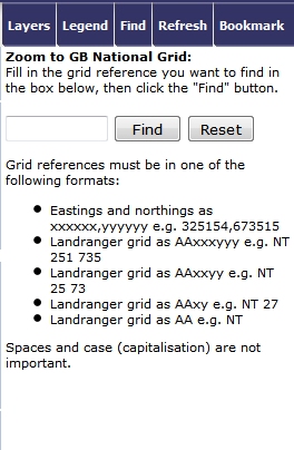
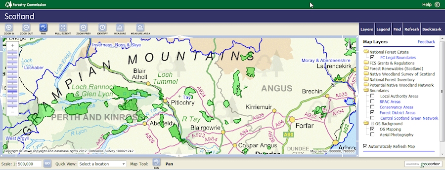
Using the interactive map
...
Use the zoom and pan control (top left above map) to zoom in and pan round the map to the precise area you've selected.
1 |
|
2 | 3 |
|
|