...
The Forestry Commission in Scotland allow geocaches to be placed anywhere on their land (subject to conditions as outlined in the Landowner Database).
You can download maps of each forest district that will open in Google Earth which is a free download for a PC and also as apps for Apple and Android. All maps are provided for information only and may not necessarily be up to date or accurate. It is the responsibility of the cache owner to check a location. Forestry Commission maps are provided under the terms of the Open Government Licence. There is also an interactive map that lets you enter coordinates and search.
...
Forest District Maps
Inverness and Moray
Galloway Forest
Dumfries and Borders
Cowal and Trossachs
West Argyll
Tay
North Highlands
Moray and Aberdeenshire
Lowlands
Lochaber
Interactive Map
This interactive map allows you to find and view Forestry Commission owned land within Wales. There are many agreements with the FC for Wales (and the whole UK) in the Geocaching Association of Great Britain Landowner database. In nearly all cases the FC require you to get permission first before placing a cache.
The MAGIC map shows FC land only for England.
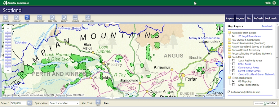
Scotland.
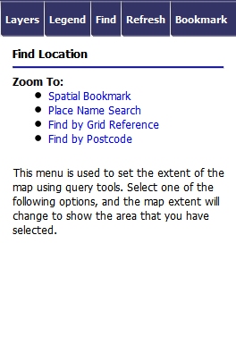
Using the interactive map
Click here to open the interactive map.
Click here to open the Forestry Commission website - list of regional offices and contacts.
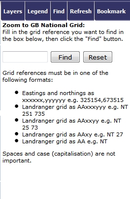
The simplest way to use the map is to paste in the coordinates where you want to search. These must be in the correct format of the Ordnance Survey British Grid (short form), example or the short form SN5743686 figure), example NJ686207 where NJ is the 100Km grid square, 687 the Easting and 207 the Northing. If you use Memory Map to obtain the coordinates they appear in the full 10 digit format like this: SN 57447 36851 NJ 68636 20792 you need to remove the last two digits of the Easting and Northing and Easting from this and the spaces: SN 57447 36851 NJ 68636 20792 to this: SN574368 NJ686207 in order for them to work.
...
- Open the map. It defaults to the whole of WalesScotland. On the right is a control box you can use to select layers and find a location. You need to select the Folder/layer "Forestry Commission National Forest Estate - FC Legal BoundaryBoundaries" but can't at this zoom level (it is greyed out). Use the zoom slider on the left to zoom in and then select the layer. You can also select the layer Administrative Areas "Forest District Areas" under Boundaries to show the FC regions which may help you with identifying where to get permission.
- You can search either by OSGB grid reference or by postcode using the control box tab Find. This shows what you can search by. Click on Grid Reference.
- Enter the OSGB coordinates and click find; the map opens.
- The area is shown as green diagonal hatching.
Use the zoom and pan control (top left above map) to zoom in and pan round the map to the precise area you've selected.
1 |
|
2 | 3 |
| |
4 | |
|
|